Showing posts with label Pictures. Show all posts

Thursday, April 16, 2015

Travel: Taiwan

TAIWAN IN BRIEF
     Taiwan, formerly known as Formosa and officially known as Republic of China, is sovereign state in South East Asia. It is a neighboring country of the Philippines, located just north of Luzon. This island country is about 180 kilometers from the southern coast of mainland China. Terrain is consisting of some flat plains and mostly rugged mountain ranges. Climate is tropical, experiencing a rainy season and hot humid weather. Typhoons are also common between July and October. Currency of Taiwan is the New Taiwan Dollar (TWD ), approximately 31.73TWD/1USD at the time of this writing. Timezone is National Standard Time (UTC+8).

HOW TO GET THERE
     There are four major international airports that serves as the gateway to Taiwan by plane. You may select any of these four depending on your place of origin and the intended place to visit in Taiwan.
Taiwan Taoyuan International Airport (IATA: TPE, ICAO: RCTP)
Location: 25° 4′ 35″ N, 121° 13′ 26″ E
     This airport is formerly known as Chiang Kai-shek International Airport but it was changed to its current name September of 2006. This airport is one of the two airports that serves the capital city Taipei and the northern part of Taiwan. Taoyuan International Airport serves the vast majority of  international flights out of Taipei area. This is the main international hub for China Airlines and EVA Air.
Taipei Songshan Airport (IATA: TSA, ICAO: RCSS)
Location: 25° 04′ 10″ N, 121° 33′ 06″ E
    This airport has a combined military and commercial purposes. Military section is known as the Songshan Air Force Base. The section for commercial purposes is officially known as Taipei International Airport. It has flights to South Korea, Japan as well as China.
Taichung Airport (IATA: RMQ ICAO: RCMQ)
Location: 24° 15′ 52.80″ N, 120° 37′ 14.09 ″E
     Another airport serving commercial and military airport, this one is located in Taichung. Serving the middle part of Taiwan, it has scheduled flights to Hanoi, Ho Chi Minh, Hongkong and Macau. Charter services to Palau, Japan, South Korea and Thailand are also available.
Kaohsiung International Airport (IATA: KHH, ICAO: RCKH)
Location: 22° 34′ 37″ N, 120° 21′ 00″ E
     Being located in the Siaogang District, the airport is also known as Kaohsiung Siaogang Airport. It is a commercial international airport serving the southern part of Taiwan. There are scheduled flights to and from Hongkong, Japan, Macau, South Korea and Vietnam.

WHERE TO STAY
There is a lot of hotels in Taiwan specially in Taipei area. The following hotels suggested are the hotels where I have stayed during my visit.

Le Midi Hotel
Location: 24° 57' 30" N, 121° 13' 12" E
     When I stayed on this hotel it is known as Jungli Chinatrust Hotel. They are the highest hotel in the Taoyuan area and provides nice panoramic view of the area. Amenities provided are laundry room and gym on the 28th floor and business center on the 27th floor. Rooms are spacious and clean with great internet connectivity by wifi or the provided LAN cable. 
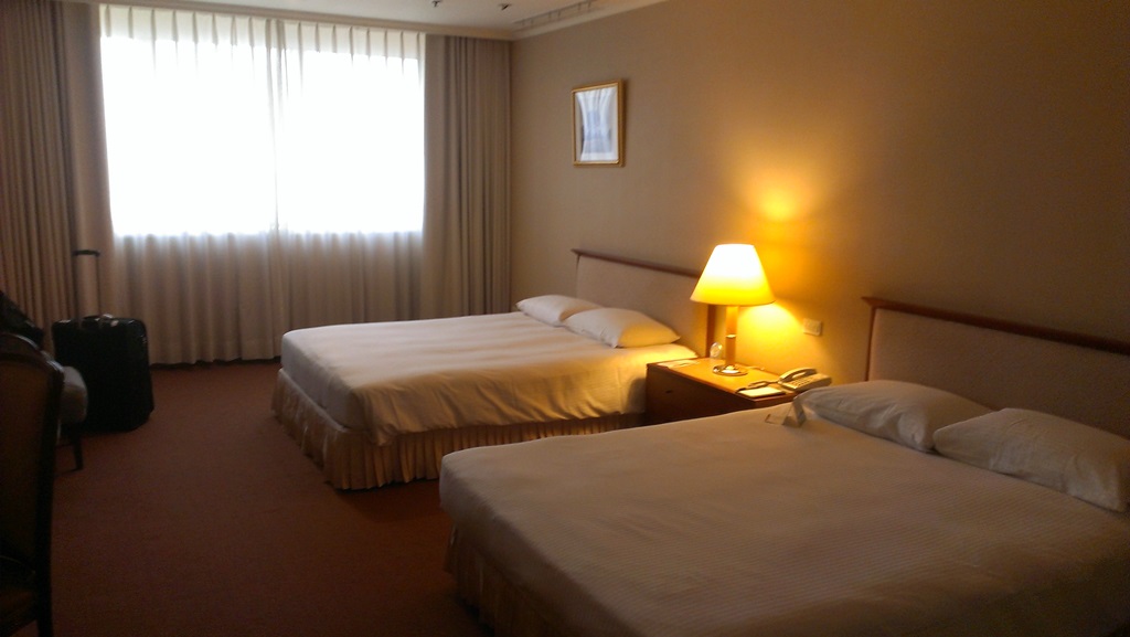
My room in Le Midi Hotel. Extra bed for my luggge :)
Fullon Hotel Jhongli
Location: 24°  57' 16.2" N, 121° 13' 24.5" E
     Fullon Hotel sits right in the business district, even the railway station is a walking distance away. Many establishments are within an easy reach from the hotel. One downside is that because it is located in a busy area, the streets' noise can be heard on some lower rooms. As much as possible pick a room in higher floors.
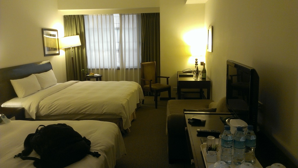
Cozy ambiance in Fullon Hotel.


Thursday, June 12, 2014

Travel: Coron, Palawan, Philippines

CORON IN BRIEF
     Coron is classified as a first class municipality located in Region 4B (MIMAROPA) in the province of Palawan. The municipality occupies the eastern half of Busuanga Island, all of Coron Island and approximately 50 other small islands including the Canipo Island on the southern end as well as the Tara Island in the northeast. All of these are part of the calamian archipelago in northern Palawan, also known as Calamian group of islands, that separates the west Philippine sea from the Sulu sea.
     The name of Coron town originated from Cuyonen term for earthen pot. It was named by Don Nicolas Manlavi Y Ledesma in reference to the shape of the bay fronting their first settlement in Barangay Banuang Daan. Coron has a total land area of 69,247.1460 hectares. It is subdivided into twenty three barangays, nineteen located in mainland and four in nearby islands. Being an island municipality, ships and planes are the main transportation means to and from Manila. Motorized boats, tricycles, jeepneys or trucks transports people and merchandise between barangays and neighboring towns.
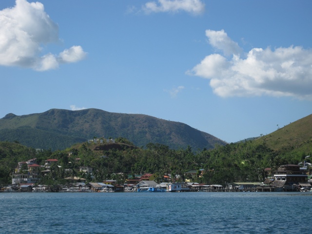
View of Coron town

HOW TO GET THERE
By plane
     Coron is accessible directly from Manila or Cebu City. There are several flights daily from Manila served by AirPhil Express, Cebu Pacific and SkyJet. Cebu Pacific also serves flights from Cebu. The domestic airport serving Coron is the Busuanga airport (IATA Airport Code: USU) also known as Francisco B. Reyes airport. Travel time from Manila to Busuanga airport is approximately 45 minutes to one hour. Direct flight from Cebu is around 40 minutes. Other Cebu flights taking the Cebu-Manila-Busuanga route will take approximately one hour and 40 minutes.
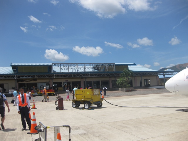
Busuanga airport or Francisco B. Reyes airport. Damage brought by typhoon Haiyan (locally: Yolanda) still visible.
By Sea
     If you prefer to travel by ship to Coron from Manila or Puerto Princesa, the best option  is the 2GO Ferry  (formerly known as Superferry). 2GO Travel travels the route Manila-Coron-Puerto Princesa and vice versa twice a week. You can contact 2GO by phone +63(02)528 7000 or email info@2go.com.ph. Other options are Atienza shipping lines and San Nicolas Shipping lines. Atienza shipping lines freighter leaves every Wednesday 6PM from pier 5 in Manila to Coron and every Saturday 6PM from Coron to Manila. Contact them at telephone numbers +63(02) 986 3118 / +63(02) 536 8123 or email them at atienzashippinglines@yahoo.com.  San Nicholas shipping line freighter on the other hand, operates several times a week plying the route Manila-Coron-Manila. For more information and booking, call them at +63(02) 245 2830 or +63(02) 243 4595

WHERE TO STAY
Asia Grand View Hotel
Location: 12° 0' 7.48" N, 120° 11' 37.26" E
     Strategically located just outside of town proper, this hotel offers a tranquil place to stay. You will feel closer to nature when you stay in this hotel. The view from the restaurant and roof-deck is very beautiful. The staffs are friendly and very accommodating. The hotel have their own brackish water pool with varying depths of 2ft, 4ft, 6ft and 8ft. Twenty spacious rooms with a balcony or porch are available.
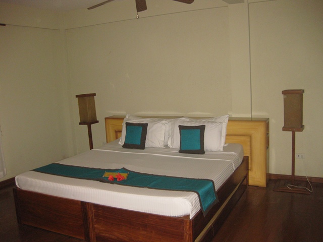
Large bed and fluffy pillows :)
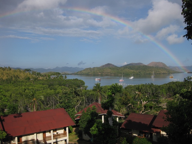
View from the restaurant

Monday, November 11, 2013

Travel: Betano, East Timor

BETANO IN BRIEF
     Betano is a village located in the southwest of Manufahi District in East Timor. During the former times, Betano was a traditional Timorese kingdom. Local language is Tetum but most locals can understand and speak Bahasa (Indonesian language) as well as Portuguese. Only few locals understand English in Betano area so it is wise to learn a few conversational phrases or better yet bring a local colleague with you.
     Local currency being used is the United States Dollar (USD) but they have their own coins. It would be practical to break your hundreds into smaller bills while you are in the capital (Dili) to make it easier to transact while in Betano. No ATM machines are available in Betano as well as in Same, the capital of Manufahi District.
     Cellular phone communication is possible as the local provider has roaming agreements with most major cellular phone company of other countries. Because this will cost you much, it is advisable to purchase a local SIM or phone. As of this writing major player is Timor Telecom but there is two new mobile networks coming in to the market, one of which is telkomcel. Internet connection is not available also, but you can go to Timor Telecom sales center in Same where they have wifi connectivity and computer terminals that you can rent. Additionally, you can purchase a USB modem from them to get mobile connectivity. Local time is TLST (UTC +9:00).

HOW TO GET THERE
     Primary point of entry to East Timor is trough the Presidente Nicolau Lobato International Airport (IATA Airport Code: DIL). This is located in Dili, the capital of East Timor. Formerly, this airport was known as Comoro International Airport. This airport serves the following airlines: Airnorth (Darwin, Australia - Dili), Air Timor which is being operated by Silk Air (Singapore - Dili), Merpati (Jakarta, Indonesia - Dili) and Sriwijaya Air (Jakarta, Indonesi - Dili).
     From Dili it is a six to eight hours of road trip. It is about 140 kilometer of travel up and around the mountains. Travel time mostly depends on weather, road conditions and driver's ability. There is also an airstrip near Same about 24 kilometers from Betano. But there are no regular flights to this airstrip. You have to arranged chartered flight from Dili on which availability will depend also on the weather conditions.
Marker of the Dili International Airport
 
WHERE TO STAY
Beach Side Hotel, Dili
Location: 8° 31' 58.96" S, 125° 36' 55.15" E
     This hotel is about thirteen kilometers from the airport. It is located right on the beach front of Branca beach hence its name. Facilities are okay and you can always have a relaxing drink by the beach or take a swim at the warm water. They don't have wifi or wired internet connection so it's good if you have the local USB modem.
     The Christo Rei, quite similar to the one in Rio de Janeiro is just a walking distance from this hotel. It is very nice to go jogging to the statue during the morning. For more information about this hotel, visit their website here.


Room of Beach Side Hotel

Restobar

Saturday, March 9, 2013

Travel: Jaffna, Sri Lanka

JAFFNA IN BRIEF
     Jaffna is the capital city of Northern Province of Sri Lanka. Amusingly, the city is located within the district of Jaffna which is located in Jaffna Peninsula. As of today, the city is 12th largest in the country. The civil war in this area has ended just in 2009 but the city is recovering so fast. Most infrastructure has already been rebuilt and continually improved by the government.
     Majority of Jaffna population are Sri Lankan Tamils thus, the common language used in the area is Tamil which is different from Sinhala used in the rest of the country. But Tamil as well as Sinhala are the official languages of Sri Lanka.
     Local currency is Sri Lankan Rupee (LKR), 1 USD is approximately equal to 127.25 LKR as of the time of this writing. The place is also tourist friendly as there are many money exchange shops and banks with ATM which accepts international cards. American Express credit card is also widely accepted, but it is advisable to take extra caution when using credit cards as some foreign scammers have been caught operating in Sri Lanka recently. Timezone is SLST (UTC +5:30).

HOW TO GET THERE
     Though there is an international airport located in Jaffna, the Jaffna International Airport (IATA Airport Code: JAF), it is not serving any international flight as of the moment. The entrypoint to the country is the Bandaranaike International Airport (IATA Airport Code: CMB). Many international airlines are operating from this airport. This airport is located about 35 km north of Colombo. 
     By March 18, a new international airport will open in Hambantota, the Mattala Rajapaksa International Airport (IATA Airport Code: HRI). This is also known as Hambantota International Airport.

WHERE TO STAY
Cinnamon Lakeside Hotel, Colombo
Location: 6° 55' 44.72" N, 79° 50' 58.28" E
     The location of the hotel which is within the central business district of Colombo is quite an advantage. Being at the side of the Beira lake also offers a fresh breeze whenever you are relaxing in the poolside. They have a lot of facilities and many different room category to choose from. For more details, visit the hotel's website.
     From Cinnamon Lakeside, the approximately 400 km travel to Jaffna by car will take about 10 hours, taking into consideration the rest stops and the speed limits. In Colombo and main towns maximum speed for cars is 50 kph and 70 kph on rural areas.

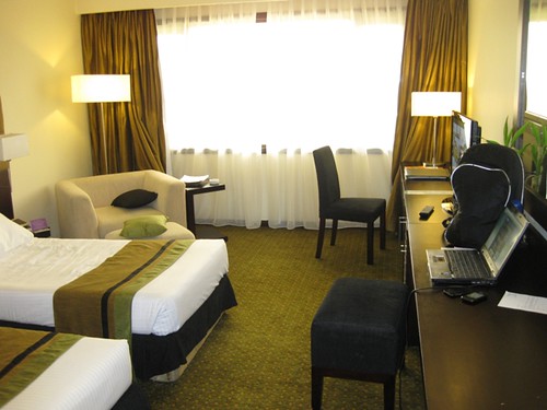
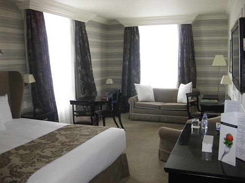
My comfortable room in Cinnamon
View from my room
Tilko Jaffna City Hotel, Jaffna
Location: 9° 39' 55.82" N, 80° 0' 38.60" E
     This hotel is located near the central business area of Jaffna. Sitting right next to the post office, the hotel is easy to find. Another advantage is that the Jaffna Fort is just a walking distance from the hotel. Rooms are spacious and they have a standby generator to give continuous power in case of utility outage which is still common to the area. Visit the hotel's website to view the room rates and preview their rooms.

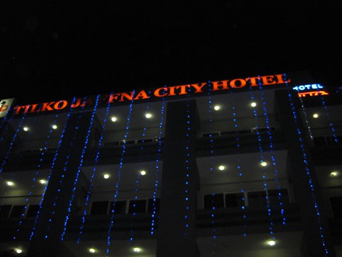
The hotel's facade at night
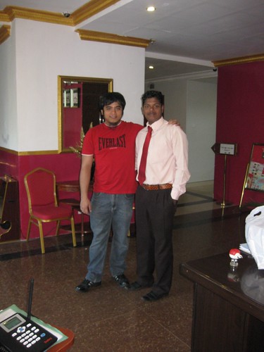
With one of the hotel's friendly staff
PLACES TO VISIT
     There are a lot of beautiful places and beaches to visit in Jaffna, but due to time constraints I only managed to visit one. Actually, the Tilko city hotel offers a Jaffna day tour, just inquire on the hotel lobby if you want to avail of this. And also, the travel to Jaffna by car from Colombo is also a rewarding experience. We pass by the national reserve and you can also see many temples and historical monuments along the way.

A monument along the way

Thursday, November 8, 2012

Travel: Quito, Ecuador

QUITO IN BRIEF
     Quito is the capital city of Ecuador and it is formerly known as San Francisco De Quito. With its location at 2800 meters above sea level, it is considered as the highest capital city in the world. Aside from being the country's capital, it is also the capital of the province of Pichincha. Despite the high altitude and being on the slope of an active stratovolcano also named Pichincha, Quito is the second most populous city of Ecuador.
     The currency being used in Quito and the whole country is United States Dollars (USD). Timezone is ECT (UTC-5). The languange being used is Spanish but most can understand English as well.

HOW TO GET THERE
     The main entry point to the country is also located in Quito as it is the capital city. But other airlines use the Guayaquil airport. Mariscal Sucre International Airport (IATA Airport Code: UIO) is the city's principal airport. It is located at a convenient driving distance of just about 10 kilometers from the city's center. A new airport outside the city limits is being built to replace this one as its current location near the high buildings makes landings quite hard at night and during foggy weather conditions.

WHERE TO STAY
Hotel Dann Carlton, Quito
Location: 0° 11' 0.92" S, 78° 28' 50.42" W
     One advantage of this hotel is that it is located in the financial and business center of the capital. The rooms are spacious and provided with the standard amenities that most hotels provide. Wifi internet, international cable television, telephone, electronic safe are available for the guests use.
     For fitness conscious guests, they also have a gym located at the Penthouse and provides a relaxing view of the city while you are working out or running on the treadmill. If you also fancy running outside, Parque La Carolina with a large track oval is just a walking distance from the hotel.

My cozy room in Dann Carlton
The view from my room. The open field is Parque La Carolina

Thursday, September 6, 2012

Travel: Bangladesh

BANGLADESH IN BRIEF
     Bangladesh is officially known as People's Republic of Bangladesh and located in South Asia. It is on the Bengal region of the eastern Indian sub continent. The name of the country means "Country of Bengal" in their official language which is Bengali. Neighboring countries are Burma (Myanmar) and India.
     The currency being used by Bangladesh is Taka (BDT), approximately $0.0123 USD. Timezone is BST (UTC +6). They drive on the left side of the road and traffic jams are normal everyday sight specially if you are on the cities. Concentration of heavy traffic is noticeable in their capital city, Dhaka. It is advisable to give about 2 hours allowance for travel if you are going out for business meetings.

HOW TO GET THERE
     Main gateway to the country is Dhaka through Shahjalal International Airport although other airlines use Chittagong and Sylhet as the point of entry. Please check wikitravel's information about travelling to Bangladesh for more details.

Thursday, May 31, 2012

Pictures: Old Phones

Been back from a long assignment abroad, I got a chance to have a short vacation. Back at my hometown, I  have cleaned some of my old stuffs and I have stumbled upon these old pieces of technology that once upon a time were awesome.

NEC Smart network locked mobile

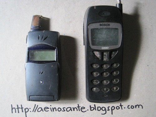
Ericsson and Bosh

Nokia 5110 and Nokia 3530

A pair of Nokia 3210


Saturday, January 21, 2012

Travel: Masbate, Philippines

MASBATE PROVINCE IN BRIEF
     Masbate is an island province of the Philippines that is located in the Bicol Region. It is composed  of three major islands: Masbate, Ticao and Burias. The lone city, Masbate City is located in the Masbate Island. The island of Masbate lies at the center of the Philippine archipelago between latitudes 11°43’ north and 123°09’ east and 124°5’ east. The boundaries are Ticao Pass on the north, San Bernardino Strait on the east, Visayan Sea on the south, and the Sibuyan Sea on the west.
     The general topographic feature of the province ranges from slightly undulating to rolling and from hilly to mountainous. With each island, the rugged topography is concentrated in the northeastern portion and gradually recedes to blunt hills and rolling areas in the southeast, southwest, and south.

HOW TO GET THERE
     There are so many options on how to reach masbate. You can travel by land, by sea or by air from different points of the country.

By Land
      There's a daily trip going to masbate via RORO bus which is a part of the nautical highway program of the government. The terminal of this bus is located at cubao in metro manila. The bus will  travel to Pilar, Sorsogon via national highway and then will be carried by the RORO boat from Pilar port to Masbate city port.  At the time of this writing, the fare is is just 1,050 pesos one way for aircon buses and  800pesos for one way for ordinary buses with the RORO boat fare inclusive. These RORO buses also travel out from Masbate City to other towns such as Aroroy and Mobo.

By Sea
     Just in case you don't prefer the RORO bus, you still have other option. You can also ride another bus that travels daily from Manila to Pilar, the board the RORO boat going to Masbate or better yet take the fastcraft operated by Montenegro Lines. The fastcraft is convenient and faster than the RORO boat but of course the fare is higher. Montenegro lines fastcraft schedules from Pilar to Masbate City are 8:00am, 11:30am and 3:30pm. Montenegro lines fastcraft schedules from Masbate to Pilar  are 5:00am, 8:00am and 12:00 noon. These schedules may change, please verify with Montenegro lines. Ferries also travels from Cebu City going to Masbate City port or Cataingan Port.

By Air
     This is by far the most convenient means of going to Masbate. The airport is now operational again after being closed for some time due to renovation and facility improvement. ZestAir and Air Philippines has daily flights going to Masbate City airport from Manila and vice versa. Flights schedule to Masbate and vice versa are shown below.


ATTRACTIONS
Rodeo Masbateño Festival
     This is an annual event which takes place in Masbate City which showcases the peoples natural skills in livestock handling, such as lassoing, wrestling, and riding cattle. Also included in the event are a fair featuring local products and exhibitions, livestock shows, animal health seminars and trade of cattle and horses. The event has taken place every summer since 1993 which usually opens with a lively parade of horseback riders.
     The highlight of the event is the rodeo competition itself. Both men and women dress up in cowboy outfits to perform stunts like lassoing on foot and on horseback, bull riding and whipping, the two-person carambola, livestock wrestling, casting down, load carrying, and other activities that is related to the handling of livestock. These events draw tourists from the rest of the Philippines and also from around the world as well as local expectators. Cowboys and bull riders of other nationalities also participate in the competitions.


Natural Sceneries
     Masbate is rich in natural wonders and breathtaking views of its coastline. Picture speaks a thousand words so just click view full post to take a look at the following pictures of lovely Masbate.

Saturday, October 29, 2011

Celebrity Sightings: Vina Morales

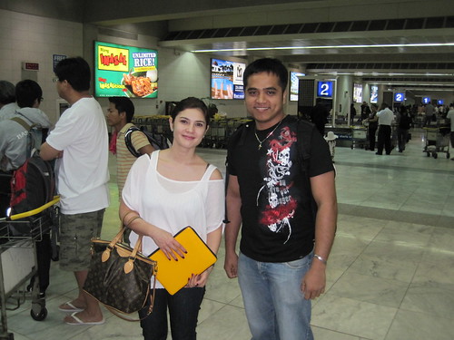
     Posing with Vina Morales near the baggage carousel of Ninoy Aquino International Airport terminal 2.

And no... We are not Mang Inasal endorsers :)


Sunday, December 12, 2010

Saturday, December 11, 2010

Random Pictures: Beautiful Sceneries of Bicol

Mt. Isarog in the morning mist
Mount Isarog at dawn.
Aerial view of hills at the foreground and Mt. Mayon
The majestic mayon volcano
View from the coastal road of masbate
The cross at Mt. Puro, Brgy. Puro Aroroy Masbate

A cave carved by waves at the tip of Ticao Island, Masbate