Quito is the capital city of Ecuador and it is formerly known as San Francisco De Quito. With its location at 2800 meters above sea level, it is considered as the highest capital city in the world. Aside from being the country's capital, it is also the capital of the province of Pichincha. Despite the high altitude and being on the slope of an active stratovolcano also named Pichincha, Quito is the second most populous city of Ecuador.
The currency being used in Quito and the whole country is United States Dollars (USD). Timezone is ECT (UTC-5). The languange being used is Spanish but most can understand English as well.
HOW TO GET THERE
The main entry point to the country is also located in Quito as it is the capital city. But other airlines use the Guayaquil airport. Mariscal Sucre International Airport (IATA Airport Code: UIO) is the city's principal airport. It is located at a convenient driving distance of just about 10 kilometers from the city's center. A new airport outside the city limits is being built to replace this one as its current location near the high buildings makes landings quite hard at night and during foggy weather conditions.
WHERE TO STAY
Hotel Dann Carlton, Quito
Location: 0° 11' 0.92" S, 78° 28' 50.42" W
One advantage of this hotel is that it is located in the financial and business center of the capital. The rooms are spacious and provided with the standard amenities that most hotels provide. Wifi internet, international cable television, telephone, electronic safe are available for the guests use.
For fitness conscious guests, they also have a gym located at the Penthouse and provides a relaxing view of the city while you are working out or running on the treadmill. If you also fancy running outside, Parque La Carolina with a large track oval is just a walking distance from the hotel.
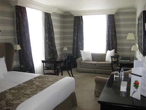 |
| My cozy room in Dann Carlton |
 |
| The view from my room. The open field is Parque La Carolina |
Quito, being declared by UNESCO in 1978 as one of the first World Cultural Heritage Sites, has many historic places. Most of these are least altered and well preserved locations. Below are some of the must visit locations while you are in Quito.
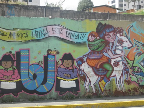 |
| An artistic graffiti on a roadside wall. |
 |
| One of the streets of Quito |
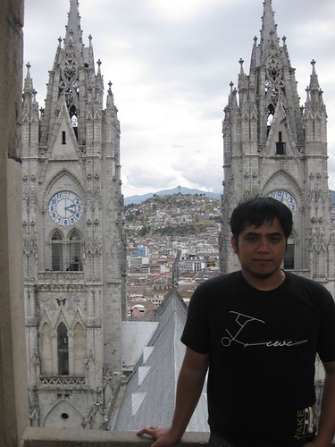
Vasilica Del Voto National (Basilica of the National Vow)
Location: 0° 12' 53.98" S, 78° 30' 26.64" W
This is a Roman Catholic church that is situated in the historic center of Quito. It is also known as Basilica de San Juan or Cathedral de Consagracion de Jesus. The construction of the Basilica has started in 1887 and until now it is still considered technically as unfinished. Donations by visitors (in the form of access tickets) and believers helps to continue the construction of the Basilica. Local urban legend states that when the Basilica is finished, the end of the world will come.
The Basilica is considered as the most important work of Neogothic Ecuadorian architecture. This is visible in the architectural design featuring grotesques in the form of the native Ecuadorian animals like iguana, tortoises and armadillos. Dimension of the Basilica is 140 meters in length and 35 meters width. The height depends on the different points of the Basilica. It is 115 meters in the frontal towers, 74 meters in the transept, 30 meters in the sanctuary and 15 meters in the votive chapels. Visitors are allowed to climb to the top of the towers even up to the bell tower where there is a panoramic view of the city and its surrounding mountains. Ticket price is USD $3 for foreign tourists and USD $1 for locals (at the time of this writing).
 |
| The facade of the Basilica |
 |
| Ticket for entering the Basilica. |
 |
| Tickets for tower access. At left is for tourists and the other one is for locals. |
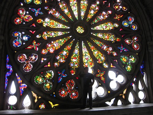 |
| The beautiful stained glass. |
 |
| Inside the roof of the Basilica, going to the bell tower. |
 |
| View from the bell tower. At the background are the two front towers. |
 |
| A pipe organ inside the Basilica. |
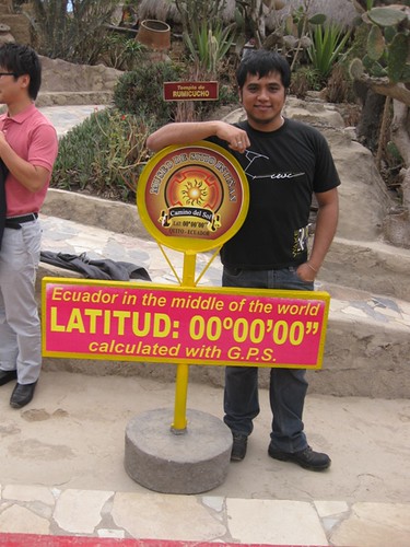
Ciudad Mitad del Mundo (Middle of the World City)
Location: 0° 0' 8" S, 78° 27' 21" W
This location is like a park where a monument was constructed to mark the location of the equatorial line. Location is conveniently located north of center of Quito. You can also find here the Museo Etnografico Mitad Del Mundo which features the indigenous ethnography of Ecuador.
The monument with a height of about 30 meters was constructed between 1979 and 1982 to replace the older and smaller marker built by the Ecuador Government under the direction of a geographer named Luis Tufiño in 1936. The older monument was built to commemorate the first Geodesic Mission of the French Academy of Sciences which is led by Pierre Bouguer, Charles Marie de La Condamine and Louis Godin. This monument is now located in a town called Calacali, about 7 kilometers away from this location.
The new monument which is pyramidal in shape is topped by a globe that is about 2.25 meter in radius and weighs about 5 tons. Each side of the monument is facing a cardinal direction. Inside you can find a small museum with displays of indigenous items pertaining to Ecuadorian culture and a miniature model of the park.
There is also a planetarium which displays the instruments used by the Geodesic mission in calculating the location of the equatorial line. Based on World Geodetic System WGS84 used on modern GPS systems and other GIS products like Google Earth, the actual equatorial line is about 240 meters north of the marked line calculated by the mission. Considering the equipment they have used on that time, the 240 meters error is still quite impressive.
Other attractions are insectarium, restaurants and diverse selection of local handicraft stores and local food served at several cafes and restaurants. During weekends, the central plaza also hosts various cultural and musical events for the tourists.
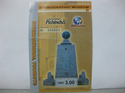 |
| The ticket to the Ethnographic Museum |
 |
| Marker on the side street of the entrance to the park. |
 |
| Inside the insectarium |
 |
| Straddling the marker line on the East side of the monument |
Intiñan Solar Museum
Location: 0° 0' 2.76" S, 78° 27' 16.37" W
Intiñan solar museum is a private attraction located at about 200 meters north east of the Ciudad Mitad del Mundo monument. They are claiming that their marked line is the true location of the equator though my GPS (a civilian GPS, accuracy of about 2 meters at the time of measuring) says otherwise and the location itself on google map is outside the 0° 0' 0" line.
The museum has English speaking tour guides and the information they provide about the ancestral culture of Ecuador is quite exceptional. They also perform experiments that they claim to be only possible near the equatorial line. It is kind of fun and amusing but I will not be very skeptic about it. What is important is that I enjoy their presentation. But if you are interested, you can do some research about this. What I enjoy the most is attempting to balance an egg on its end on a head of a nail. If you manage to do so, a certificate will be given to you. Also bring your passport with you because they also stamp it with a commemorative stamp.
They demonstrate what they claim the coriolis effect on the rotation of water down the drain depending on the location with reference to the equatorial line. Though coriolis effect is true, it is just significant on macro scale. Rotation of water down the drain is much affected by the direction it enters the vessel. (See the video below)
 |
| Intiñan equatorial line marker (red line) |
 |
| Galapagos tortoise |
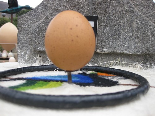 |
| I successfully balanced an egg :) |
 |
| The certificate they give when you have balanced an egg. |
 |
| The commemorative stamp on my passport. |
| The demonstration of coriolis effect by our guide |
Templo del Sol
Location: 0° 1' 23.94" N, 78° 28' 51.84" W
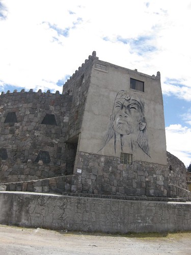
About 1.5 kilometer from Intiñan Solar Museum is another museum that features the rich culture of Ecuadorian art. The building's architecture and interior design will make you feel like you were in some kind of archaeological site. What my driver told me is that this museum was created by the initiative of an Ecuadorian artist named Christopher Ortega. Visit the artist's webpage for more information about him and the museum.
 |
| Magnificent view outside the museum |
 |
| Templo del Sol |
 |
| Inside Templo del Sol |
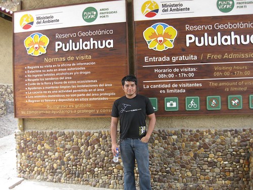
Reserva Geobotánica Pululahua (Pululahua Geobotanical Reserve)
Location: 0° 1' 31.34" N, 78° 28' 59.50" W
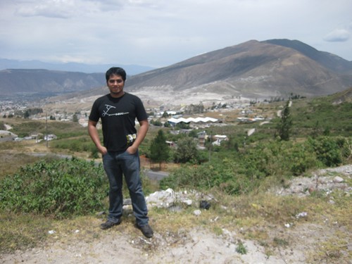
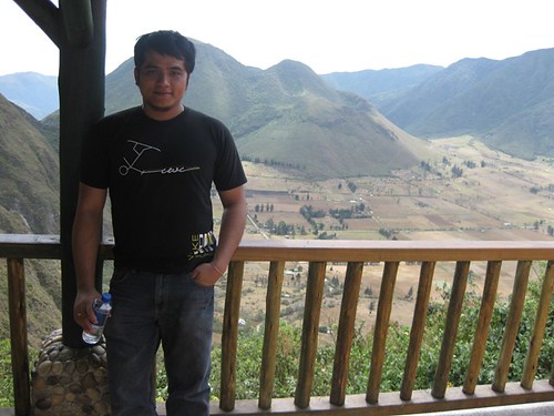
Located just 500 meters from Templo del Sol it is also practical to visit this place. This is a protected area around Pululahua volcano just 17 kilometers north of Quito. The volcano's crater is visible from this spot. This crater is one of only few in the world with human inhabitants. The view is exhilarating and the soft breeze will surely relax. I recommend this stop before the drive back to the city.
 |
| The entrance to the site with overlooking view of the crater. |
 |
| The crater at the background. Buildings and houses rooftops are visible. |
No comments:
Post a Comment